Southeast Region
CONGAREE NATIONAL PARK
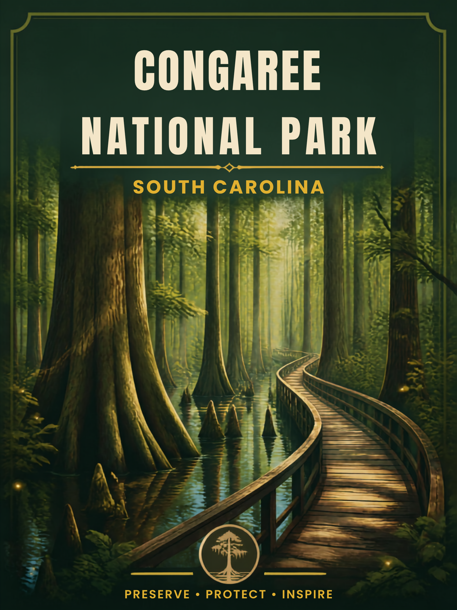
Welcome to Congaree National Park, a hidden gem located in central South Carolina. Known for its towering old-growth hardwood forest, rich biodiversity, winding waterways, and floodplain ecosystem, the park offers visitors the chance to experience one of the last remaining intact old-growth bottomland forests in the southeastern United States.

Did You Know?
- Congaree National Park is home to one of the few populations of synchronous fireflies in North America.
- The park was originally designated as Congaree Swamp National Monument even though it is technically a floodplain forest rather than a swamp.
- The Congaree and Wateree Rivers flood the park roughly 10 times each year.
- Some loblolly pines in the park are among the tallest trees in eastern North America.

My Personal Experience
What a difference a month makes. I visited Congaree National Park twice, once in June and then again years later in November. The experiences could not have been more different. During my June visit, the mosquitoes absolutely ate me alive. I was still joking when I first saw the famous “Mosquito Meter” at the visitor center showing the daily mosquito activity level. My first thought was: “How bad can it really be?” Well, you are standing in a humid floodplain forest in South Carolina, and there are really only two possible answers: bad or very bad. Thankfully I had brought insect repellent, although even that only partially helped. The mosquitoes were relentless. At some point I stopped trying to win the battle and simply accepted that I was donating blood to the ecosystem.
November, on the other hand, was fantastic. Cool temperatures, low humidity, and almost no bugs completely changed the atmosphere of the park. I spent time near the visitor center and walked the elevated boardwalk trail to learn more about the park’s natural history. Congaree does not offer the dramatic mountain vistas of western parks, and the trail system is relatively small, but there was something incredibly peaceful about walking underneath these enormous old trees while surrounded by complete quiet.
The park also offers a marked canoe trail through Cedar Creek, which many visitors consider the best way to experience Congaree. Personally, I decided to pass. Paddling through narrow swamp channels with alligators nearby sounded slightly more adventurous than I was looking for that day.

Basic Facts
Address:
Congaree National Park
100 National Park Road
Hopkins, SC 29061
Operation Hours and Seasons:
The park is open 24 hours a day, year-round. The visitor center has seasonal hours.
Visitors:
Approximately 160,000 per year (2022)
Entrance Fees:
Entrance to the park is free.
Website:
nps.gov/cong
Map:
nps.gov/cong/planyourvisit/maps.htm
Additional Information:
For additional local information, visit discovercongaree.com.

Best Time to Visit
Spring (end of May / beginning of June) offers the best opportunity to experience the park’s famous synchronous fireflies, though visitors should be prepared for heat, humidity, and mosquitoes.. Winters are quiet an bug free but with the highest risk of trails being flooded. Fall is arguable the best overall season with comfortable hiking conditions, lower humidity and less bugs. Come in summer if you like intense heat, extreme humidity, frequent thunderstorms, and heavy mosquito activity.

Recommended Time
1 Day: Congaree is a small park. Explore the Harry Hampton Visitor Center area, walk the Boardwalk Loop Trail, and hike one or two shorter trails through the floodplain forest.
2-3 Days: Add canoeing or kayaking on Cedar Creek, longer hikes, wildlife viewing, and photography during sunrise or sunset.

Getting There
The closest city is Columbia, South Carolina. From Columbia take SC-48 (Bluff Road) southeast toward the park entrance. Driving time should be about 30 minutes.

Weather
Congaree National Park experiences a humid subtropical climate.
- Spring (March to May): 70s–80s°F (21–32°C). Warm temperatures, blooming vegetation, and increasing humidity.
- Summer (June to August): 80s–90s°F (27–37°C). Very hot and humid with heavy mosquito activity and frequent afternoon thunderstorms.
- Fall (September to November): 70s–80s°F (21–32°C). Pleasant temperatures with lower humidity and fewer insects.
- Winter (December to February): 40s–60s°F (4–16°C). Mild temperatures, fewer insects, and generally pleasant hiking conditions.
Flooding is common throughout the year and may temporarily close trails.

Hiking
Congaree is a relatively small park, and nearly all trails begin near the Harry Hampton Visitor Center:
Easy:
- Boardwalk Trail – 2.6 miles loop: Elevated boardwalk through the heart of the old-growth floodplain forest with excellent accessibility and educational exhibits. It is the park’s signature hike and one of the best introductions to the floodplain ecosystem, passing giant hardwoods, cypress trees, and seasonal floodwaters.
- Bluff Trail – 1.8 miles round trip: Passes through upland forest ecosystems that contrast with the lower floodplain areas. Offers a contrast to the swampy lowlands by traversing slightly higher and drier terrain along the edge of the floodplain.
Moderate:
- Weston Lake Loop Trail – 4.5 miles round trip: Scenic forest trail leading to Weston Lake with opportunities for wildlife viewing and solitude. One of the park’s most scenic hikes, combining old-growth forest, cypress knees, wildlife habitat, and quiet sections away from the busiest trails.
- Fork Swamp Trail – 0.6 miles round trip: A short but atmospheric trail that provides a close look at the swamp-like environments many visitors associate with Congaree.
Strenuous:
- Oakridge Trail – 7.1 miles loop: A longer wilderness route through some of the park’s least-visited areas, ideal for hikers seeking solitude.
- River Trail – 11.1 miles round trip: Follows the Congaree River through remote bottomland forest and offers a deeper appreciation of the flooding processes that sustain the ecosystem.
Always check trail conditions before hiking. Flooding can quickly affect accessibility.
Canoeing and Kayaking
Explore the park’s waterways by canoe or kayak. The Congaree River Blue Trail and Cedar Creek provide excellent opportunities for paddling and wildlife viewing. The latter is a 15-20 mile paddling trail through flooded forest, cypress trees, swamp channels and wildlife habitat. Guided tours and rentals are available through nearby outfitters. Many experienced visitors consider Cedar Creek the best way to experience Congaree. Paddling allows access to sections of the floodplain forest that hikers rarely see and provides excellent opportunities to observe wildlife in a quiet setting.
Fishing
Fishing is permitted in designated waterways. Anglers can catch species like catfish, bass, and sunfish. A valid South Carolina fishing license is required.

Scenic Drives
The park is best explored on foot or by canoe. There are no scenic roads in the park.
Best Viewpoints
- Boardwalk Loop Trail: The best location to appreciate the immense scale of the park’s old-growth forest and towering loblolly pines.
- Weston Lake Overlook: Located on the Weston Lake Trail offers a scenic look over the lake. Excellent spot for birdwatching, wildlife photography and forest reflections.
- Bates Ferry Trail: The trail provides a scenic direct view along the banks of the Congaree River. Provides one of the few unobstructed views of the Congaree River itself.
Wildlife Viewing
Congaree supports an impressive variety of wildlife despite its relatively small size. White-tailed deer, river otters, wild turkeys, turtles, snakes, and numerous bird species are regularly observed. American alligators are present, particularly in wetter areas. Birdwatchers may spot barred owls, pileated woodpeckers, prothonotary warblers, and migratory species during spring and fall. Early morning and late afternoon generally provide the best wildlife viewing opportunities.

Photography
Congaree is a fantastic park for forest and low-light photography:
- Sunrise & Morning Fog: Early morning light filtering through the trees creates atmospheric scenes.
- Forest Photography: The towering trees and floodplain environment create dramatic vertical compositions. Seasonal flooding creates mirror-like reflections among cypress trees and hardwood forests, producing some of the park’s most unique photographic opportunities.
- Night Photography: Minimal light pollution offers excellent opportunities for astrophotography and firefly photography in late spring
- Wildlife Photography: Patience is rewarded throughout the park’s wetlands and waterways.

Horseback Riding
Horseback riding is not permitted within Congaree National Park. Some private horseback riding operators are available elsewhere in central South Carolina.

General Aviation
There are reliable rental car options in the cities of Columbia, Sumter, and Orangeburg. The latter might be the preferred option if you would like to avoid dealing with busy class C airspace over Columbia (Columbia Metro – KCAE) or Fort Sumter (Shaw AFB – KSSC).
Orangeburg Municipal Airport (KOGB) in Orangeburg, SC:
- 44 miles south of the park
- 4,508 asphalt runway
- 100LL available
If you do not mind operating near or in class C airspace or with military traffic, the following two airports are alternatives for Orangeburg.
Jim Hamilton L B Owens Airport (KCUB) in Columbia, SC:
- 17 miles northwest of the park
- 5,011 asphalt runway
- 100 LL available
Sumter Airport (KSMS) in Sumter, SC:
- 36 miles northeast of the park
- Longest runway 5,501 feet
- 100 LL available
Summer heat and humidity can significantly impact density altitude. Afternoon thunderstorms are common. Morning fog occasionally develops near rivers and wetlands. Columbia airspace can become busy with airline, military, and GA traffic.

Nearby Attractions
- Columbia: South Carolina’s capital with museums, restaurants, and historic districts
- Sesquicentennial State Park: Forested park with paddling and hiking opportunities
- Harriet Barber House: Late 1800-s home that preserves the African American and Reconstruction-era history of the local rural communities.
- Charleston: Historic coastal city ideal for extending a southeastern road trip

Important Tips
- Mosquitoes: During warmer months, mosquito activity can become extreme. Strong insect repellent is essential.
- Flooding: Trails may flood rapidly after rain events.
- Hydration: South Carolina humidity and heat can become exhausting, especially during summer.
- Footwear: Waterproof or mud-resistant hiking shoes are strongly recommended.
- Navigation: Some backcountry trails can become difficult to follow during floods.
- Wildlife Awareness: Snakes, alligators, and insects are part of the ecosystem respect wildlife and keep safe distances.
- Firefly Lottery: Access to the synchronous firefly viewing event is controlled through a lottery system. Check the park website well in advance if you hope to attend.
- Flood Conditions: Flooding can occur even after rainfall far upstream. Always check current trail conditions before visiting.
Congaree National Park is one of the most underrated and misunderstood parks in the eastern United States. It may not offer dramatic mountain vistas or famous landmarks, but the park rewards visitors with quiet wilderness, towering old-growth forests, rich biodiversity, and an atmosphere that feels timeless. Walking beneath giant trees while surrounded by floodwaters, birdsong, and stillness offers a rare glimpse into the natural landscape that once covered much of the American Southeast.


