Rocky Mountain Region
CANYONLANDS NATIONAL PARK
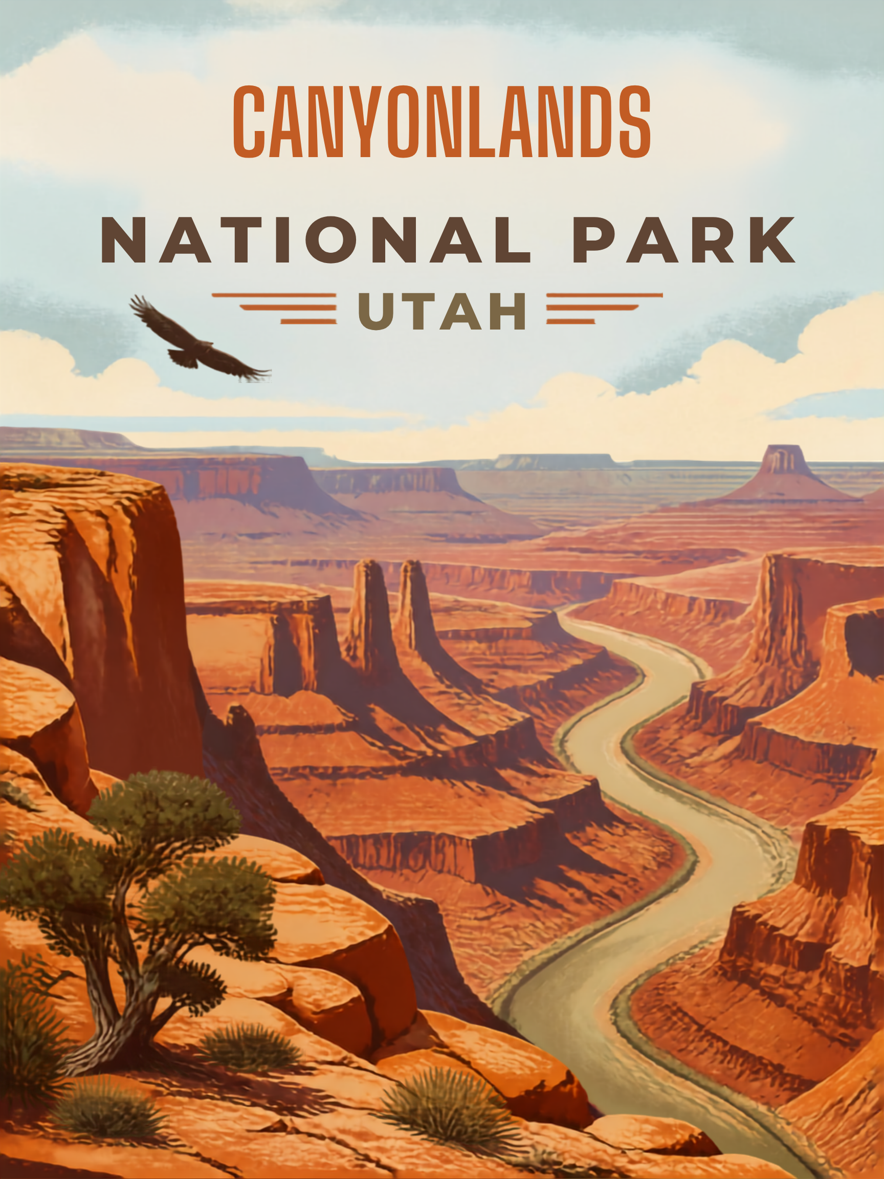
Welcome to Canyonlands National Park, a vast wilderness of deep canyons, towering mesas, dramatic buttes, and winding rivers located in southeastern Utah. Carved over millions of years by the Colorado and Green Rivers, Canyonlands preserves some of the most spectacular desert scenery in North America.
The park is divided into three distinct districts: Island in the Sky, The Needles, and The Maze. Each offers a unique perspective on this immense landscape. Whether you are standing on a thousand-foot overlook above the rivers, hiking among colorful sandstone spires, or venturing into one of the most remote backcountry areas in the United States, Canyonlands rewards visitors with a sense of scale and solitude that is increasingly rare in the modern world.

Did You Know?
- Canyonlands National Park protects more than 337,000 acres of canyon country.
- The Colorado and Green Rivers divide the park into three districts that are not directly connected by roads.
- The Maze is considered one of the most remote and challenging areas in the National Park System.
- Upheaval Dome remains one of the park’s greatest geological mysteries. Scientists still debate whether it was created by a meteorite impact or the collapse of an underground salt dome.

My Personal Experience
Canyonlands is one of the mighty five National Parks in Utah and I visited it twice. I couldn’t believe that a park in such proximity to Arches could be so different. I was in awe and found it fascinating what the confluence of Colorado and Green River created. If you go there in a rental (as I did) you might be limited to the Islands in the Sky district, unless you want to violate your rental contract and drive off-road. Even if you did, you’d better have that 4×4. I visited the Island in the Sky district only , but the landscape was so impressive that I hang one of my pictures into my office and am pretty certain that I inspired my coworkers. I combined both visited with nearby Dead Horse State Park which I thinks is a must-not-be-missed.
Basic Facts
Address:
2282 Resource Blvd.
Moab, UT 84532
Operation Hours and Seasons:
The park is generally open 24 hours a day, year-round. Some facilities might be closed in winter.
Visitors:
911,000 per year (2021)
Entrance Fees:
- Private Vehicle – $30.00 admits one private, non-commercial vehicle and all its occupants
- Per Person – $15.00
Website:
nps.gov/cany
Map:
nps.gov/cany/planyourvisit/maps.htm
Additional Information:
For additional local information, visit discovermoab.com

Best Time to Visit
Spring and fall are generally the best times to visit Canyonlands National Park. Comfortable temperatures, clear skies, and excellent hiking conditions make these seasons ideal for exploring all three districts.
Summer can be extremely hot, particularly in lower elevations where temperatures frequently exceed 100°F. Visitors should plan outdoor activities for early morning or evening hours and carry plenty of water.
Winter offers solitude, cooler hiking conditions, and occasional snow-dusted landscapes that create striking contrasts against the red rock formations. While some services operate on reduced schedules, many visitors enjoy the park’s quieter atmosphere during this season.

Recommended Time
1 Day: Focus on the Island in the Sky district. Visit Mesa Arch, Grand View Point, Green River Overlook, and Upheaval Dome. This provides an excellent introduction to the park’s dramatic scenery.
2-3 Days: The ideal amount of time for most visitors. Spend one day in Island in the Sky and dedicate another day to exploring the Needles district. Add Dead Horse Point State Park and several longer hikes.
Getting There
The Green and Colorado rivers cut the park into three districts:
- Islands in the Sky – This district in the north of the park. Take UT313 from Moab, UT. Driving time is about 40 minutes.
- The Needles – It takes about 90 minutes from Moab, UT or an hour from Monticello, UT via UT 211 to get to the district in the southeast corner of the park
- The Maze – This district lies in the west of the park and is the most remote. All roads in this district require a high-clearance AWD. You have to drive 46 miles of dirt road from UT 24 to get to the ranger station.

Weather
Canyonlands National Park experiences a semi-arid climate characterized by hot summers, mild winters, and low precipitation. Here’s an annual overview of the average weather:
- Winter (December to February): 30°F to 50°F (-1°C to 10°C). Nights can be chilly, with temperatures dropping below freezing, averaging in the 20s°F (-6 to -1°C). Snowfall is possible but relatively rare, with most precipitation falling as light snow showers or flurries. Winter skies are often clear, making it a popular time for hiking and exploring the park without the crowds of the warmer months.
- Spring (March to May): 60°F to 80°F (15°C to 27°C). Spring sees occasional rainfall, with an average precipitation of around 0.5 to 1 inch per month. Wildflowers bloom, creating bursts of color across the landscape.
- Summer (June to August): daytime temperatures frequently exceeding 90°F (32°C) and occasionally reaching over 100°F (38°C). Summer nights offer some relief with temperatures dropping into the 60s°F (15-20°C). Rainfall is minimal during the summer months, with occasional thunderstorms bringing short but intense downpours.
- Fall (September to November): 60°F to 80°F (15°C to 27°C). Nights start to become cooler, with temperatures dropping into the 40s°F (4-9°C). Fall is generally dry, with low precipitation levels similar to spring.
Hiking
Canyonlands National Park offers a variety of hiking trails that lead to dramatic overlooks, hidden canyons, and awe-inspiring vistas. Here are some recommended hikes for the three districts:
Island in the Sky: Explore the Island in the Sky district, accessible from the park’s northern entrance. Please note that water is scarce. Carry at least 1 quart (1 liter) of water per person for short and up to a gallon (4 liters) for longer trails.
Easy:
- Mesa Arch Trail – 0.5 miles round trip: Short hike leading to a captivating sunrise spot. Get your camera ready.
- Grand View Point Trail – 1.8 miles round trip: This trail follows the canyon edgeandoffers breathtaking panoramic views of the canyons below.
Moderate:
- Upheaval Dome – 0.6 miles one way: A short but steep trail leads to Upheaval Dome.
- Whale Rock – 1.0 miles round trip: Hikers cross steep slick rocks on this trail.
Strenuous:
- Gooseberry Canyon – 5.4 miles round trip: The trail to Gooseberry Canyon is the Island in the Sky’s steepest trail. Step carefully on this trail which should take 4-6 hours.
- Alcove Spring – 11.2 miles round trip: Hikers descent past a large alcove into a wide canyon to the base of the Moses and Zeus towers.
The Needles: Hikers find over 60 miles of interconnecting trails in the Needles district. Four short self-guided trails are available along the scenic drive. Check the visitor center or trailheads for trail guides.
Easy / Moderate:
- Cave Spring – 0.6 mile loop: This trail takes hikers to a historic cowboy campus and prehistoric rock paintings. You need to climb two ladders.
- Pothole Point – 0.6 miles round trip: Hikers need to follow cairns to stay on this trail that leads to pothole communities. You will have views of the Needles.
Strenuous:
- Peekaboo – 10.8 miles round trip: Hikers will cross both Wooden Shoe and Lost Canyon on this trail to Salt Creek Canyon. Prehistoric rock paintings at the end near Peekaboo will reward the hiker for this challenging trail on steep slopes and nearby cliffs. Two ladders have to be climbed.
- Druid Arch – 10.8 miles round trip: Arguably the hike with the most spectacular views in this district. The average hiker needs 5-7 hours for this trail. The last quarter mile is steep and requires climbing a ladder and some scrambling.
The Maze District: The Maze is the most remote district and access to trailheads is difficult. Hikers in the Maze typically plan multi-day backpacking trips.
Moderate:
- Hotshot Canyon – 7 miles round trip: This hike takes about 4-5 hours to complete. The trail moderately descends into a deep sandy canyon bottom where you can visit petroglyph sites. The hike is not recommended during summer months as the trail provides minimal shade only.
Strenuous:
- Maze Overlook – 1 mile round trip. The trail descends steeply to a wash bottom. Basic climbing maneuvers are required and hikers need to carry a 25-foot rope to raise and lower backpacks.

Scenic Drives
- Island in the Sky Scenic Drive: This 34-mile round-trip drive is the park’s premier scenic route and provides access to many of Canyonlands’ most famous overlooks and trailheads. Highlights include Mesa Arch, Green River Overlook, Grand View Point, and Upheaval Dome.
- Needles Scenic Drive: The road into The Needles district travels through colorful desert landscapes and provides access to numerous trailheads and viewpoints. Several short interpretive trails are located along the route.
- The Maze Backcountry Roads: The Maze is accessed via a network of challenging dirt roads that require high-clearance four-wheel-drive vehicles. These routes are considered adventures in themselves and lead to some of the most remote landscapes in the lower 48 states.
Best Viewpoints
- Mesa Arch: One of the most famous viewpoints in Utah. Sunrise illuminates the underside of the arch and creates one of the most photographed scenes in the Southwest.
- Grand View Point: Offers sweeping views across canyons, mesas, and distant mountain ranges. The overlook showcases the immense scale of the park.
- Green River Overlook: A spectacular viewpoint where visitors can observe the Green River winding through the canyon below.
- Dead Horse Point: Located just outside the park boundary, this viewpoint provides one of the most iconic vistas in the American Southwest and is a must-see when visiting Canyonlands.
- Druid Arch: One of the most impressive destinations in The Needles district and a rewarding objective for experienced hikers.
Wildlife Viewing
Although geology dominates the landscape, Canyonlands supports a surprisingly diverse array of wildlife. Visitors commonly encounter mule deer, desert cottontails, rock squirrels, ravens, and numerous lizard species. Bighorn sheep occasionally appear in more remote areas, while golden eagles can often be seen soaring above the canyon rims. Early morning and evening provide the best opportunities for wildlife viewing, particularly during spring and fall when temperatures are more moderate.

Photography
For photography enthusiasts, Canyonlands National Park presents endless opportunities to capture the beauty of the desert landscape. Here are some photography hotspots:
- Sunrise and Sunset: The soft, warm light during sunrise and sunset creates magical moments over the canyons. Mesa Arch and Grand View Point are excellent spots for capturing these magical hours.
- Green River Overlook: This vantage point offers a captivating view of the Green River winding through the canyons, especially stunning during the golden hours.
- Dead Horse Point State Park: While not part of Canyonlands National Park, this nearby state park is worth a visit for its incredible views of the Colorado River meandering through the canyons and the famous “Goosenecks.”
Horseback Riding
Your horse (or burro or mule) needs water. Lack thereof is a limiting factor for horseback riding in Canyonlands National Park. You can take your horse on all backcountry roads and in Horseshoe Canyon. Note that cross-country travel is prohibited.
Day use permits are free of charge and are generally unlimited. The Horse/Salt Creek and Lavender canyons in the Needles limited day use to seven animals per day. In all other areas of the park, group size must not exceed ten animals and ten people. If you would like to stay overnight, expect to pay $36 for the permit. All manure and feed must be packed out when you leave. You have to feed pelletized for 48 hours in advance and for the during of your stay in Canyonlands to prevent the spread of foreign plant species. Please check the park’s website for details at nps.gov/cany/planyourvisit/horsebackriding.htm.
Not bringing your own horse? No problem! Outfitters in nearby Moab offer guided tours outside the park.
General Aviation
As a private pilot, you can fly into Canyonlands Airport (KCNY), located just outside the park’s boundaries.
Canyonlands Field Airport (KCNY) in Moab, UT:
- Approximately 16 miles from Island in the Sky district
- Longest runway: 7,360 feet
- 100LL available
- Excellent choice for pilots visiting Canyonlands, Arches, and Dead Horse Point
A useful alternative with additional services is
Grand Junction Regional Airport (KGJT) in Grand Junction, CO:
- Approximately 110 miles from the park
- Longest runway: 10,501 feet
- 100LL available
Pilots flying into the Moab area should pay close attention to density altitude during the summer months, especially during afternoon operations. Mountainous terrain surrounds much of the region and can create localized turbulence and strong winds. Thunderstorms occasionally develop during the summer monsoon season and may affect visibility and flight conditions. The scenery, however, is among the finest found anywhere in the American Southwesterrain surrounds much of the region, and gusty winds or localized turbulence are not uncommon. Afternoon thunderstorms can also develop quickly during the monsoon season, making preflight planning especially important.
Nearby Attractions
- Dead Horse Point State Park: Located immediately adjacent to Island in the Sky, this state park offers one of the most spectacular overlooks in North America and should be considered an essential addition to any Canyonlands itinerary.
- Arches National Park: Only a short drive away, Arches protects more than 2,000 natural stone arches and complements Canyonlands perfectly.
- Moab, Utah: The gateway community for both Canyonlands and Arches offers lodging, restaurants, outfitters, rafting trips, and mountain biking opportunities.
- Colorado River Corridor: Scenic drives, rafting trips, kayaking excursions, and hiking opportunities are available along the river between Moab and Canyonlands.
- Manti-La Sal National Forest: Visitors looking for cooler temperatures and alpine scenery will find a completely different environment in the nearby La Sal Mountains.
Important Tips
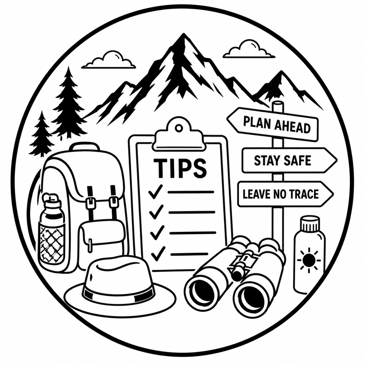
- Carry More Water Than You Think You Need: Water sources are extremely limited throughout the park. Dehydration is one of the most common visitor safety concerns.
- Know Which District You Are Visiting: The three districts are separated by significant driving distances and cannot be easily combined in a single day.
- Respect the Desert Environment: Cryptobiotic soil is a fragile living ecosystem that may take decades to recover from a single footprint. Stay on designated trails and durable surfaces.
- Plan Ahead for The Maze: Visitors entering The Maze should have extensive backcountry experience, detailed maps, emergency supplies, and reliable communications equipment.
- Fuel Up Before Entering the Park: There are no gas stations inside Canyonlands National Park.
- Check Road Conditions: Weather events can quickly affect dirt roads and backcountry routes, particularly in The Maze district
Canyonlands National Park showcases the immense power of water, time, and geology. The Colorado and Green Rivers have spent millions of years carving one of the most spectacular landscapes in North America, creating a world of canyons, mesas, arches, towers, and hidden wilderness.
While neighboring Arches National Park often receives more attention, Canyonlands offers something increasingly rare: space. Vast distances, remarkable solitude, and breathtaking vistas allow visitors to experience the American Southwest on a truly grand scale. Whether you spend a few hours overlooking the canyons from Island in the Sky or several days exploring the remote reaches of The Maze, Canyonlands is a park that leaves a lasting impression long after the trip is over.


