Rocky Mountain Region
CANYONLANDS NATIONAL PARK
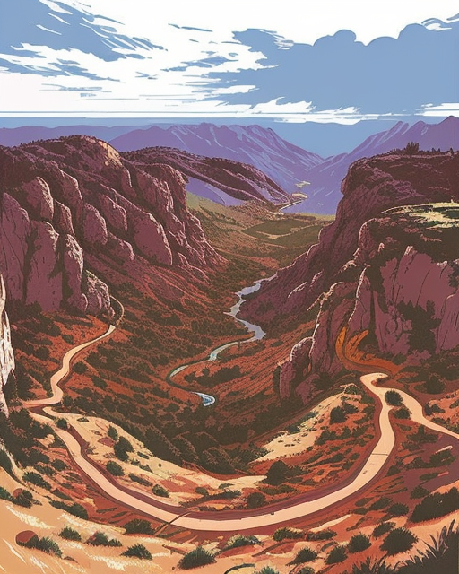
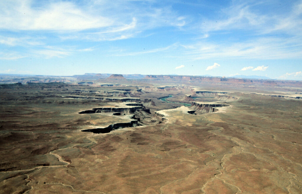
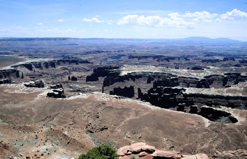
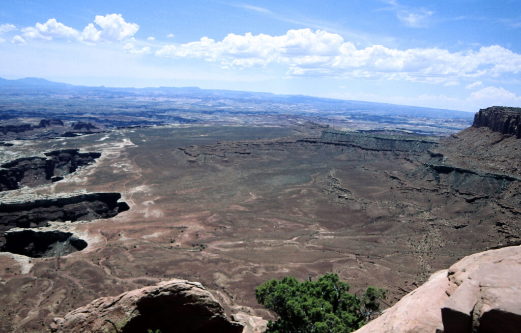
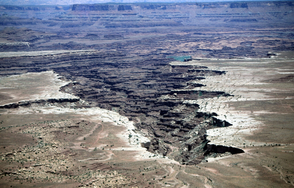
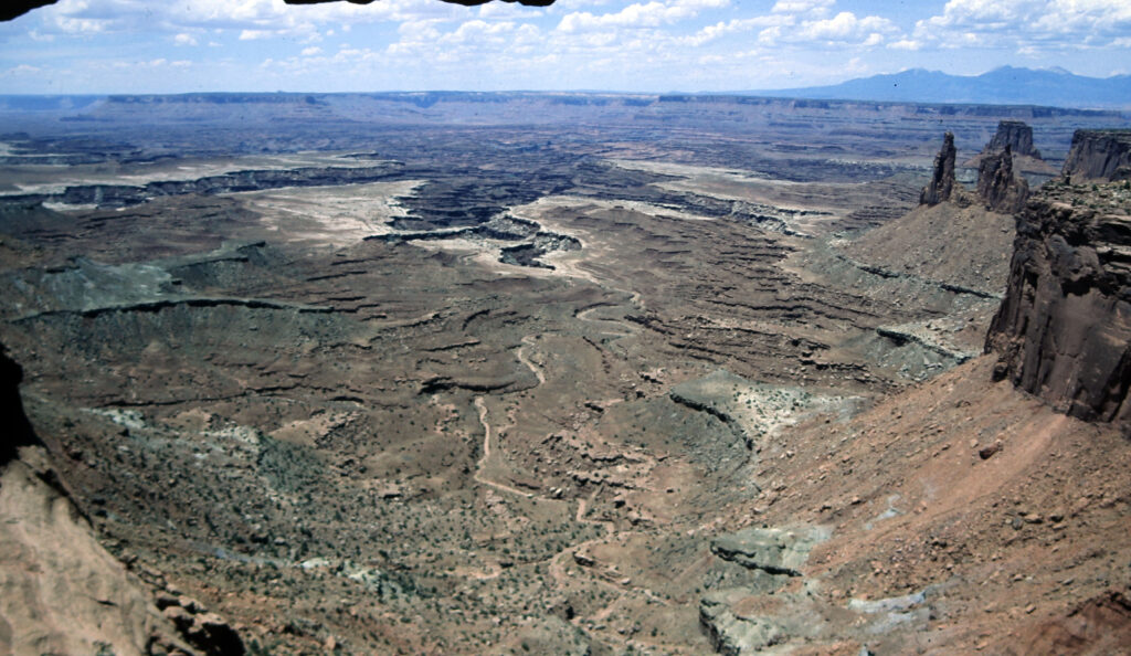
Canyonlands National Park is a mesmerizing desert landscape located in southeastern Utah. Spanning over 337,000 acres, this park is a haven for outdoor enthusiasts, who would like to explore canyons and buttes formed by the Colorado River and its tributaries. These rivers divide the park into three different districts: Island in the Sky, The Needles, and The Maze.

Basic Facts
Address:
2282 Resource Blvd.
Moab, UT 84532
Operation Hours and Seasons:
The park is generally open 24 hours a day, year-round. Some facilities might be closed in winter.
Visitors:
911,000 per year (2021)
Entrance Fees:
Private Vehicle – $30.00 admits one private, non-commercial vehicle and all its occupants
Per Person – $15.00
Website:
nps.gov/cany
Map:
nps.gov/cany/planyourvisit/maps.htm
Additional Information:
For additional local information, visit discovermoab.com

Getting there
The Green and Colorado rivers cut the park into three districts:
- Islands in the Sky – This district in the north of the park. Take UT313 from Moab, UT. Driving time is about 40 minutes.
- The Needles – It takes about 90 minutes from Moab, UT or an hour from Monticello, UT via UT 211 to get to the district in the southeast corner of the park
- The Maze – This district lies in the west of the park and is the most remote. All roads in this district require a high-clearance AWD. You have to drive 46 miles of dirt road from UT 24 to get to the ranger station.

Weather
Canyonlands National Park experiences a semi-arid climate characterized by hot summers, mild winters, and low precipitation. Here’s an annual overview of the average weather:
Spring (March – May):
- Temperatures begin to warm up, with daytime highs ranging from 60°F to 80°F (15°C to 27°C).
- Spring sees occasional rainfall, with an average precipitation of around 0.5 to 1 inch per month.
- Wildflowers bloom, creating bursts of color across the landscape.
Summer (June – August):
- Summer brings hot and dry weather to Canyonlands, with daytime temperatures frequently exceeding 90°F (32°C) and occasionally reaching over 100°F (38°C).
- Summer nights offer some relief with temperatures dropping into the 60s°F (15-20°C).
- Rainfall is minimal during the summer months, with occasional thunderstorms bringing short but intense downpours.
Fall (September – November):
- Fall brings milder temperatures, with daytime highs ranging from 60°F to 80°F (15°C to 27°C).
- Nights start to become cooler, with temperatures dropping into the 40s°F (4-9°C).
- Fall is generally dry, with low precipitation levels similar to spring.
Winter (December – February):
- Winter in Canyonlands is mild compared to other parts of the country, with daytime temperatures averaging between 30°F to 50°F (-1°C to 10°C).
- Nights can be chilly, with temperatures dropping below freezing, averaging in the 20s°F (-6 to -1°C).
- Snowfall is possible but relatively rare, with most precipitation falling as light snow showers or flurries.
- Winter skies are often clear, making it a popular time for hiking and exploring the park without the crowds of the warmer months.
Overall, Canyonlands National Park offers a diverse climate throughout the year, with each season providing unique experiences for visitors. It’s important to check weather forecasts before visiting and to come prepared for the specific conditions of the season.
Let’s dive into the various activities you can enjoy during your visit:
Hiking
Canyonlands National Park offers a variety of hiking trails that lead to dramatic overlooks, hidden canyons, and awe-inspiring vistas. Here are some recommended hikes for the three districts:
Island in the Sky: Explore the Island in the Sky district, accessible from the park’s northern entrance. Please note that water is scarce. Carry at least 1 quart (1 liter) of water per person for short and up to a gallon (4 liters) for longer trails.
Easy
- Mesa Arch Trail is a short 0.6 miles hike leading to a captivating sunrise spot. Get your camera ready.
- Grand View Point Trail offers breathtaking panoramic views of the canyons below. This trail follows the canyon edge and is 1.8 miles long
Moderate
- Upheaval Dome A short 0.6 miles but steep trail leads to Upheaval Dome.
- Lathrop Hike this 5 miles long across open grasslands and see spectacular views of Airport Tower and the Colorado
Strenuous
- Gooseberry Canyon The trail to Gooseberry Canyon is the Island in the Sky’s steepest trail. Step carefully on this 4.6 miles trail which should take 4-6 hours.
- Alcove Spring Hikers descent past a large alcove into a wide canyon to the base of the Moses and Zeus towers.
The Needles: Hikers find over 60 miles of interconnecting trails in the Needles district. Four short self-guided trails are available along the scenic drive. Check the visitor center or trailheads for trail guides.
Easy / Moderate
- Cave Spring This short 0.6 miles loop trail takes hikers to a historic cowboy campus and prehistoric rock paintings. You need to climb two ladders.
- Pothole Point leads to pothole communities. You will have views of the Needles. Hikers need to follow cairns to stay on this 0.6 miles trail.
Strenuous
- Peekaboo Hikers will cross both Wooden Shoe and Lost Canyon on this 10.8 miles trail to Salt Creek Canyon. Prehistoric rock paintings at the end near Peekaboo will reward the hiker for this challenging trail on steep slopes and nearby cliffs. Two ladders have to be climbed.
- Druid Arch Arguably the hike with the most spectacular views in this district. The average hiker needs 5-7 hours for this 10.8 miles trail. The last quarter mile is steep and requires climbing a ladder and some scrambling.
The Maze District: The Maze is the most remote district and access to trailheads is difficult. Hikers in the Maze typically plan multi-day backpacking trips.
Moderate
- Hotshot Canyon This 7 mile hike takes about 4-5 hours to complete. The trail moderately descends into a deep sandy canyon bottom where you can visit petroglyph sites. The hike is not recommended during summer months as the trail provides minimal shade only.
Strenuous
- Maze Overlook This one mile trail descends steeply to a wash bottom. Basic climbing maneuvers are required and hikers need to carry a 25-foot rope to raise and lower backpacks.

Photography
For photography enthusiasts, Canyonlands National Park presents endless opportunities to capture the beauty of the desert landscape. Here are some photography hotspots:
- Sunrise and Sunset: The soft, warm light during sunrise and sunset creates magical moments over the canyons. Mesa Arch and Grand View Point are excellent spots for capturing these magical hours.
- Green River Overlook: This vantage point offers a captivating view of the Green River winding through the canyons, especially stunning during the golden hours.
- Dead Horse Point State Park: While not part of Canyonlands National Park, this nearby state park is worth a visit for its incredible views of the Colorado River meandering through the canyons and the famous “Goosenecks.”
Horseback Riding
Your horse (or burro or mule) needs water. Lack thereof is a limiting factor for horseback riding in Canyonlands National Park. You can take your horse on all backcountry roads and in Horseshoe Canyon. Note that cross-country travel is prohibited.
Day use permits are free of charge and are generally unlimited. The Horse/Salt Creek and Lavender canyons in the Needles limited day use to seven animals per day. In all other areas of the park, group size must not exceed ten animals and ten people.
If you would like to stay overnight, expect to pay $36 for the permit. All manure and feed must be packed out when you leave. You have to feed pelletized for 48 hours in advance and for the during of your stay in Canyonlands to prevent the spread of foreign plant species. Please check the park’s website for details.
Not bringing your own horse? No problem! Outfitters in nearby Moab offer guided tours outside the park.
General Aviation
As a private pilot, you can fly into Canyonlands Airport (KCNY), located just outside the park’s boundaries. The airport provides facilities for general aviation pilots and offers stunning views of the surrounding landscape during landing and takeoff. Before your flight, make sure to check weather conditions and be aware of any airspace restrictions in the area.

Important Tips
- Weather and Terrain: Be prepared for varying weather conditions and rugged terrain during hikes. Carry plenty of water, wear appropriate clothing, and sturdy footwear.
- Safety: Inform someone about your hiking plans and expected return time. Cell phone coverage may be limited in some areas, so carry a map, compass, or GPS device.
- Environmental Awareness: Help preserve the delicate desert ecosystem by staying on designated trails, not disturbing wildlife, and packing out all trash. And Please: Stay off the Arches!
- Backcountry Permits: If you plan to explore the backcountry or spend the night camping, you’ll need a backcountry permit. Check with the visitor center for information and availability.
Enjoy your time in Canyonlands National Park, and may your aerial and ground explorations provide you with unforgettable memories and stunning photographs of this captivating desert landscape!

My personal experience
Canyonlands is one of the mighty five National Parks in Utah and I visited it twice. I couldn’t believe that a park in such proximity to Arches could be so different. I was in awe and found it fascinating what the confluence of Colorado and Green River created. If you go there in a rental (as I did) you might be limited to the Islands in the Sky district, unless you want to violate your rental contract and drive off-road. Even if you did, you’d better have that 4×4.

